Featured Story


How did the B.Y. Park get its name?
In the spring of 1888, the Turtle Creek Valley Railroad, headed by George Westinghouse, began construction of a railroad line from the Pennsylvania Railroad main line in South Trafford to Murrysville.
The main purpose of the rail line was to supply gas drilling equipment to the Murrysville area. With time, coal was found in the area and the rail line was extended to Export, White Valley, Delmont, Slickville, and Saltsburg to bring the coal to the Pittsburgh market.
 In November 1888, the Pennsylvania Railroad purchased the Turtle Creek Valley Railroad and operated it until the 1950 era as a branch line. In constructing the Turtle Creek Valley rail line it was necessary to divert the waters of the Turtle Creek. The diversion occurred just beyond the current split rail fence located in the park today. The diversion was accomplished with the massive boulders and fill. The photo above shows the waters of the Turtle Creek making a nearly 90-degree turn running next to the rail tracks. The tracks appear in the lower right corner of the picture. In doing this, the original creek bed was abandoned. At one time, the original creek flow ran along the base of the hill just behind the present pavilions. The water would have been a sweeping flow in the vicinity of the present restrooms and would have proceeded south along the base of the far hill (the hill closest to 7th Street).
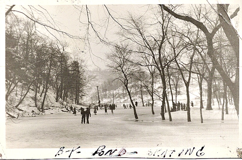
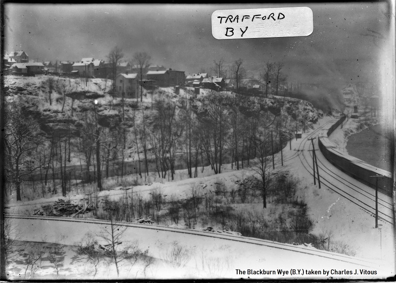 Photo of the B.Y. taken in the early 1930s by Charles J. Vitous (courtesy Donald Vitous). Added here Jan 12, 2019.
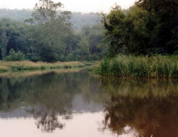
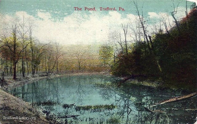 The path of the original creek in that area was shallow and it soon filled in with overgrown vegetation and weeds. For many, this swampy area became known as the greenie pond. The area was eventually filled in when the pond was dredged in 1995. The old creek path (the current side of the pond closest to the parking lot) has a solid rocked bottom. The pond is spring fed and has a depth of 4 feet at the Eastern end and has a 12-foot depth in front of Pavilion #2.
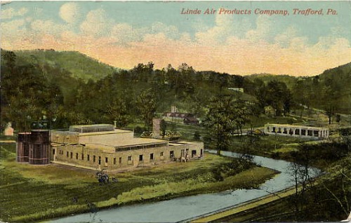
In 1902, George Westinghouse purchased land in Stewart Station for the purpose of building a manufacturing plant and a town. He completed the construction of the manufacturing facility in 1903 and established the town in 1904, naming the new town Trafford after Trafford Park in England.
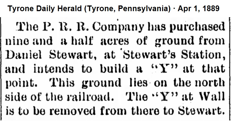
To provide workers for the foundry, the Pennsylvania Railroad ran six passenger trains daily to Trafford from Pittsburgh. The steam locomotives of the time were manufactured to only travel forward for long distances with a limited reverse function. In order to turn the locomotives for the return trips to Pittsburgh a "wye" (Y) had to be built on the Turtle Creek Valley branch of the Pennsylvania Rail Road. In railroad terminology the word wye would let an engineer know that there is a place to turn the locomotive.

This movement would look similar to a car making a three-point turn. The engineer would pull the locomotive with the passenger cars to the area between the hills in the present park. The train engineer would disconnect the passenger cars and proceed to back the locomotive along the hill to the area just beyond the restroom. The brakeman would throw a track switch that would direct the locomotive forward along the right side of the pond to the rail line headed south. After reconnecting the passenger cars, the train would proceed to the Westinghouse plant entrance and the North Trafford Station.
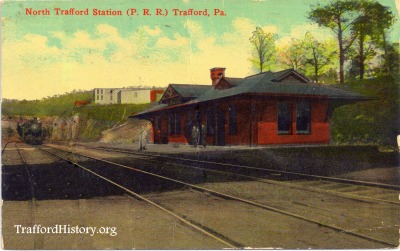
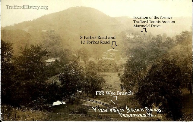
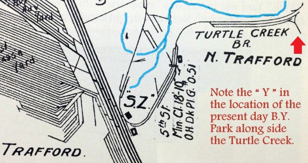
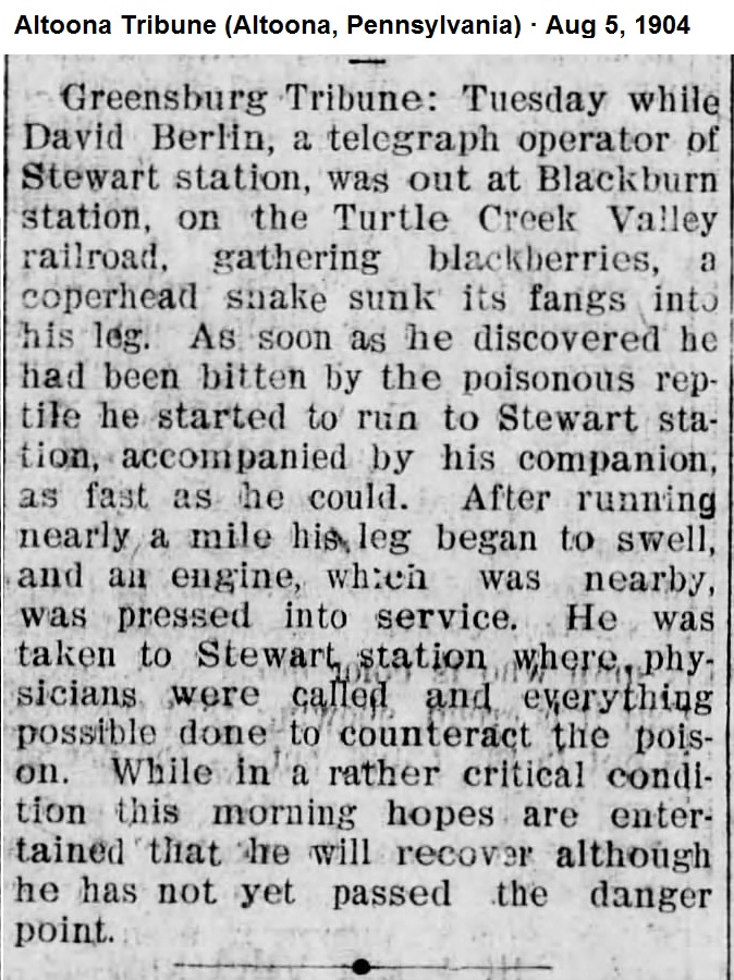
Original Pennsylvania Railroad survey maps dated 1895 document the existence of a passenger station located just beyond the buildings currently facing Forbes Road. The station was designated as the "Blackburn Station" named after the Blackburn Family that owned the farm purchased by the Turtle Creek Railroad. A newspaper article below from 1904 also mentions the Blackburn Station. The original railroad survey map indicates that there was a wye at this station. The "B.Y." stands for Blackburn Wye or Blackburn Y. The locomotive engineer assigned to take a passenger train from Pittsburgh to Trafford knew that the locomotive could be turned in the Blackburn Wye (B-Y) on the Turtle Creek Branch of the rail line.
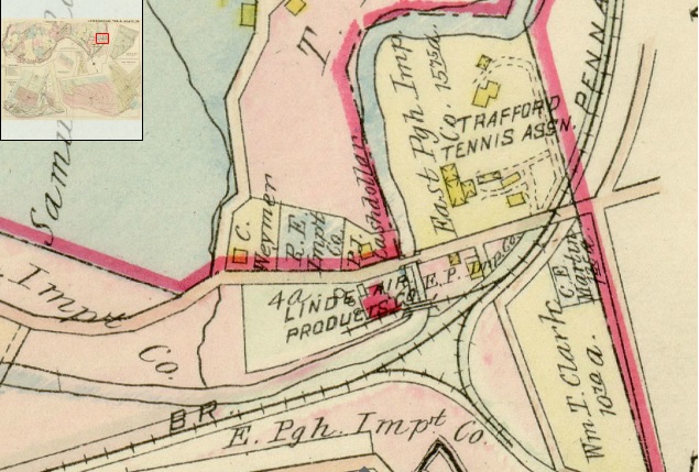
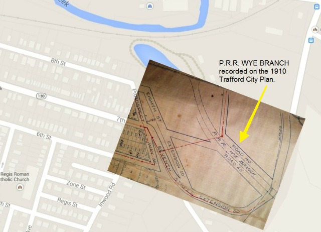
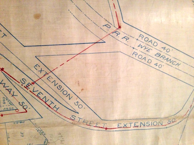
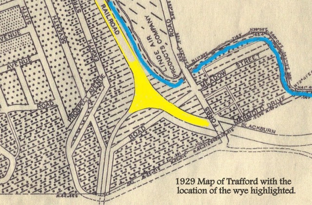
The maps and photos below illustrate the location of the wye (Y). The first map created by the G.M. Hopkins Company in 1915 shows the Y across from Line Aire Company and also illustrates the location of the Trafford Tennis Association, north of the tracks. On the 1910 Trafford City map, you can see that the city planners were looking to extend 8th Street, which would have run parallel to Prospect Ave. However, the 8th Street Extension was never built but you can see the location of the Pennsylvania Rail Road Wye Branch on this map. The 1910 map was placed over top of a current map to show the location of the wye branch if it existed today.
Story was written by Reynold Peduzzi and Andrew Capets.
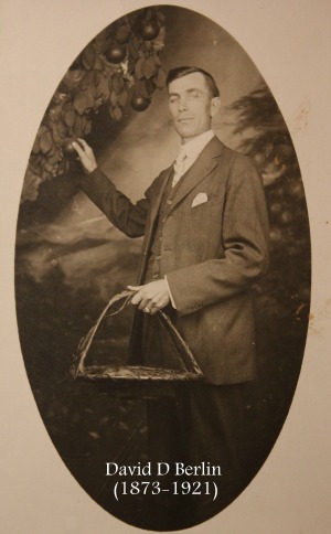 David Berlin, the telegraph operator in the above story, survived the snake bite. He was 31 years old when the incident occurred. His great-granddaughter shared this studio portrait of David. He married Mary M Leffler in 1898. Together they had three children (Doris, Helen, and Lyndal). David died in 1921 at the age of 48.
Photos or postcards provided by Andrew Capets, Jean Capets, Steve Novakovich, Lynn Lloyd, Chris Baker, and Donald Vitous.